
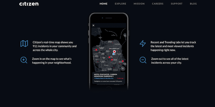
On Sunday, the New York Times published an interesting piece on a free app called Citizen (for iOS and Android) that’s been growing its user base quickly. The app uses a GPS-powered map to identify happenings, dangers and emergency incidents in your city by channeling active and recent 911 activity. As the Times writes, you show up on the Citizen map as a blue dot “surrounded by other, often larger dots, in red and yellow. Each represents an incident, either of the ‘Recent’ or ‘Trending’ variety, that has recently been reported in your proximity, and that may even be unfolding at the very moment.”
The app invites users to contribute details and even video when it is safe for them to do so, but at its core, the Times writes, “Citizen is essentially a transcription service for emergency radio. The company employs teams of people to listen to police, fire and emergency radio transmissions and to submit certain categories of incident for including in the app.” From a sample day in Midtown Manhattan, it provides these examples of alerts:
-PEDESTRIAN STRUCK BY CAB
-MAN ROBBED WOMAN OF WALLET
-REPORT OF FIREARM DISPLAYED IN SUBWAY STATION
-IRATE M.T.A. BUS DRIVERS DISPUTING
-TAXI ENGULFED IN FLAMES
So far, Citizen only serves the NYC metropolitan area, the San Francisco Bay metropolitan area, Baltimore, and Los Angeles. See the full story for much more on Citizen and the forces driving it.