

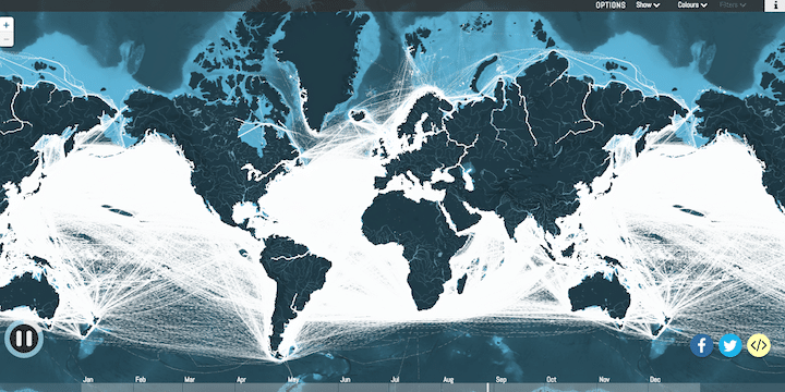
Ever wonder what routes cargo ships take around the globe? With Shipmap, you can watch a year’s worth of cargo ships—the heavy-lifters of the global economy—move on a beautiful, green, interactive map of the world. The map is built from 250 million data points taken from ships in 2012, between January 1 and December 31 of that year, and it can be configured to highlight routes, ship type, types of cargo (from liquid gas to fresh fruit), and seasonality. It’s both informative and mesmerizing.
Note: When you first arrive on the page, a British-accented narrator introduces the map and provides some detail on the importance of cargo ships to our world. It’s interesting, but if you want to skip ahead you can just click to the end in the circle progress bar in the bottom-left (around the pause/play button).
Related: You Can See Every Active and Proposed NYC Construction Project on This Map